
Topographic Surveyors in Coulsdon
Get in TouchAt Survexa, we provide topographic surveying services in Coulsdon, offering detailed mapping and analysis of land features. Our surveys use the latest technology to determine elevation and slope, ensuring precise data for construction, land development, and environmental planning.
Covering the CR5 2 area, our team is dedicated to delivering high-quality survey results for varied uses.
What Is a Topographic Survey?
A topographic survey is a detailed examination of the land's surface to capture natural and manmade features. At Survexa, we conduct these surveys throughout Coulsdon to map elevations, contours, structures, vegetation, and utilities.
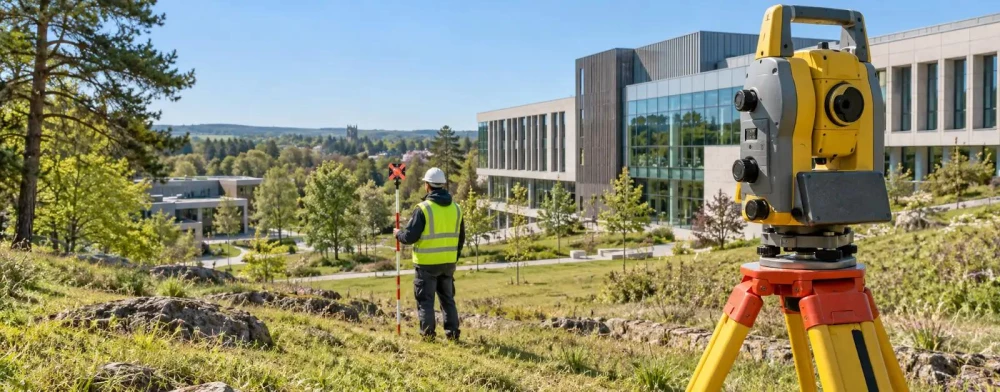
Our surveyors use precision instruments such as total stations and GPS to gather accurate data on site topography and terrain. By applying the latest photogrammetry techniques and aerial drone technology, we can swiftly gather information even in areas with difficult access.
These surveys are essential for architects planning new buildings, engineers designing infrastructure like roads or pipelines, and land developers assessing site feasibility. We adhere to RICS standards to ensure the highest accuracy and reliability.
This information supports architects, engineers, and land developers in planning and decision-making processes, offering valuable insights into site conditions. Contact us to discuss your project requirements and find out how our surveys can benefit your development.
How Much Does a Topographic Survey Cost in Coulsdon?
Topographic surveys typically cost between £300 and £1,200 in Coulsdon. The price depends on factors like site size, location, and complexity.
For instance, surveys of urban sites with significant elevation changes and dense vegetation may incur additional costs due to the need for specialised scanning technology and additional fieldwork time. We often use high-resolution GPS systems and laser scanning technology to capture detailed topographic features, ensuring the accuracy and reliability of our data.
Additionally, meeting project timelines might involve more personnel and equipment, impacting the overall cost. The specific requirements, such as contour mapping or underground utility location, also influence pricing.
At Survexa, we offer competitive pricing and use advanced equipment to provide accurate results. Our team ensures every survey is tailored to your specific needs, offering a precise quote following the initial consultation.
Contact us for more details.
Book Topographic Surveyors Today
Why Choose Survexa for Topographic Surveying in Coulsdon?
Choosing Survexa means partnering with experienced professionals in Coulsdon who are skilled in capturing the exact features of a site. We use total stations and GPS technology as part of a geodetic framework, ensuring accuracy down to the millimetre and compliance with ISO 9001 standards.
Our services include producing detailed contour maps, elevation models, and 3D terrain visualisations, all crafted to fit your project's requirements, whether for residential, commercial or infrastructure developments. We also incorporate drone photogrammetry for extensive area coverage, reducing on-site survey time significantly.
Our surveys provide crucial data for urban planning, construction, and environmental management. Speak to our experts today to benefit from our expertise.
What Types of Topographic Surveys Are Available in Coulsdon?
In Coulsdon, Survexa offers several types of topographic surveys, each providing unique insights for various projects.
Boundary Surveys: Define property lines and legal boundaries, often using Theodolites and GPS equipment to ensure accuracy for land ownership and legal documentation.
Detailed Surveys: Capture intricate site features such as utility locations, existing structures, and vegetation. Total stations and 3D laser scanners are typically used in larger urban areas to provide precise data for architectural design and urban planning.
Contour Surveys: Focus on elevation change and land gradient, useful for flood risk assessments and drainage planning. We often employ GIS software to create digital elevation models that assist in environmental impact studies.
As-Built Surveys: Document completed projects for reference and permits, confirming that construction has adhered to architectural plans. These are vital for final inspections and obtaining occupancy certifications.
Each survey type fulfils specific project requirements, supplying critical data for informed planning and development. Reach out today to discuss which survey suits your needs.
What Are the Benefits of Topographic Surveys in Coulsdon?
Topographic surveys in Coulsdon offer numerous benefits for various industries and projects. By employing techniques such as GPS surveying and laser scanning, we collect high-resolution data that serves multiple purposes:
Accurate Planning: Provides precise data for construction and development, aiding in the design of reliable infrastructure and reducing costly errors.
Risk Reduction: Identifies potential site issues early, such as floodplain areas and unstable ground, which helps mitigate risks before construction begins.
Resource Management: Assists in efficient land use and resource allocation by mapping natural features and man-made structures, optimising project planning and sustainability.
Compliance: Ensures adherence to local regulations and zoning laws by mapping boundaries and assessing environmental impact in line with standards such as the RICS guidelines.
Our surveys equip planners and developers with the information needed to make informed decisions, facilitating successful project execution and long-term asset management. Contact us to discuss how our topographic surveys can benefit your next project.
What Does a Topographic Survey Work On?
Topographic surveys are suitable for mapping various features, including:
Natural terrain contours
Vegetation and water bodies
Existing structures and utilities
Roads and pathways
These surveys are integral to both residential and commercial projects, allowing us to capture detailed spatial data that supports planning and design. We use advanced total stations and GPS technology to ensure precise measurements of topographical features.
Our surveys also adhere to RICS standards for accuracy in mapping the physical attributes of a site. By identifying potential elevation changes and geographical obstacles, we help clients mitigate risks and streamline project planning.
Survexa in Coulsdon provides tailored surveys to match the specific requirements of your site, ensuring comprehensive data collection. Contact us to discuss how our topographic survey services can assist in your upcoming project.
Speak to a Topographic Surveyors Expert
Frequently Asked Questions
How soon can a topographic survey be scheduled in Coulsdon?
We aim to schedule surveys within one to two weeks in Coulsdon. Contact our team to check availability and book your survey.
How accurate are topographic surveys?
Our topographic surveys in Coulsdon are accurate to within a few centimetres, depending on site conditions and the equipment used. We ensure precision in every survey.
What equipment do you use for topographic surveys?
At Survexa, we use tools like total stations, GPS, and 3D laser scanners to ensure precision and efficiency in our surveys.
Are topographic surveys affected by weather conditions?
Adverse weather can impact survey timelines. However, our team plans accordingly and ensures minimal disruption to project schedules in Coulsdon.
Can you provide digital copies of the survey results?
Yes, we provide digital copies of our survey results, including CAD files and detailed reports, to facilitate further planning and analysis.
Get a Free Quote for Topographic Surveying in Coulsdon
Contact Survexa today for a professional topographic survey in Coulsdon.
We cover Coulsdon (Greater London)