
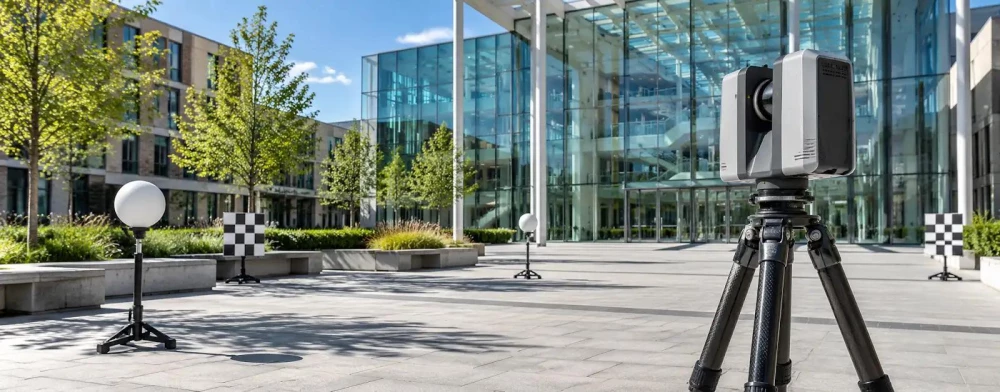
3D Laser Surveyors in Redditch
Get in TouchAt Survexa, we provide expert 3D laser surveying services in Redditch to deliver highly accurate spatial data and mapping solutions. Our technology captures detailed and precise measurements suitable for a range of industries, including construction, civil engineering, and architecture.
Covering Redditch and the B97 4 postcode area, we ensure comprehensive data sets for project planning and execution. Request a quote today for your project needs.
What Is a 3D Laser Survey?
A 3D laser survey is a process where we use advanced laser technology to capture precise spatial data of physical environments. This involves using LiDAR (Light Detection and Ranging) scanners, which emit laser beams to measure distances from the scanner to surfaces, enabling the creation of highly accurate 3D models.
At Survexa, our service is ideal for complex construction sites, historic buildings, and large-scale civil engineering projects in Redditch, enabling detailed analysis and planning supported by accurate measurements and visual models. The data collected can be used to assess structural integrity, monitor construction progress, and plan renovations with reduced risk of errors.
Our surveys adhere to industry standards such as the RICS (Royal Institution of Chartered Surveyors) guidelines, ensuring the reliability of our outputs. For any project that requires reliable and precise environmental mapping, our 3D laser survey service is a valuable tool.
How Much Does a 3D Laser Survey Cost in Redditch?
A 3D laser survey typically costs between £500 and £1,500 in Redditch, depending on the project's size and complexity. Costs are influenced by factors such as site accessibility, the survey area's detail level, and the required deliverables.
Equipment like terrestrial laser scanners or UAV-mounted LiDAR systems may also affect pricing. Projects that require high-resolution scans or comprehensive orthophoto generation will generally be at the higher end of the price range.
For instance, a survey for a large, multi-storey commercial property with extensive detail needs may require additional fieldwork and post-processing time. Additionally, compliance with industry standards such as PAS 128 for utility surveys may necessitate more specialised techniques.
For a precise quotation tailored to your specific needs, contact us to discuss your project in the B97 4 area.
Why Choose Survexa for 3D Laser Surveys in Redditch?
Choosing Survexa for your 3D laser survey in Redditch ensures you benefit from our expertise and the latest surveying technology. Our highly skilled team employs advanced LiDAR and terrestrial laser scanners to capture precise spatial data efficiently.
This allows us to generate comprehensive 3D models for construction planning, heritage conservation, and urban development projects.
We adhere to recognised standards such as ISO 9001 to ensure consistent quality in our survey outputs. Our equipment can achieve millimetre-level accuracy, which is crucial in industries where precision is paramount, like architecture and engineering.
Additionally, we offer detailed volumetric analysis for mining and quarrying operations, enabling accurate resource management and site planning.
By choosing us, you receive thorough data interpretation and visualisation, supporting informed decision-making throughout your project. Contact us today to discuss your 3D laser survey needs.
What Are the Benefits of 3D Laser Surveys in Redditch?
3D laser surveys offer several advantages for projects in Redditch, including their ability to deliver precise and reliable data quickly. This technology uses LiDAR (Light Detection and Ranging) which captures measurements with millimetre precision, ensuring thorough and detailed project assessments.
Accuracy: Capture every detail with millimetre precision, crucial for tasks such as clash detection in construction and retrofits.
Efficiency: Complete surveys faster than traditional methods, reducing project timelines by using automated scanning technology like Faro or Leica scanners.
Safety: Obtain data from hard-to-reach or hazardous areas without direct contact, minimising the need for scaffolding or elevated work platforms.
Flexibility: Use the data for architectural, engineering, and construction applications, as well as for monitoring structural deformations and heritage preservation.
These benefits make 3D laser surveying an ideal choice for any industry requiring precise spatial information, contributing significantly to operational efficiencies and risk management. Contact us today to learn how we can support your project.
Speak to a 3D Laser Surveyors Expert
Frequently Asked Questions
How is the data from a 3D laser survey used?
The data from a 3D laser survey can be used to create highly detailed and accurate models for design, analysis, and visualisation in various industries, including construction and heritage conservation.
How accurate are 3D laser surveys?
Our 3D laser surveys at Survexa typically achieve an accuracy of within 1 to 2 millimetres, ensuring precise and reliable data for critical project applications.
How long does a 3D laser survey take?
The duration of a 3D laser survey can range from a few hours to several days, depending on the size and complexity of the site and the level of detail required.
What industries benefit from 3D laser surveys?
Industries such as construction, civil engineering, architecture, and archaeological conservation benefit significantly from the detailed and precise data provided by 3D laser surveys.
Get a Free Quote for 3D Laser Surveys in Redditch
For reliable 3D laser surveying services in Redditch, contact Survexa today. Our team is ready to assist with your survey needs, providing accurate data and professional insights.
We cover Redditch (Worcestershire)